Adrian Leskiw’s Fictional Road Maps
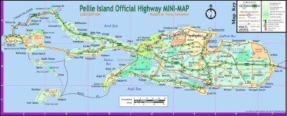
The Map Realm: The Fictional Road Maps of Adrian Leskiw is a marvellous collection of hand-drawn and digitally made highway maps of non-existent places conjured straight from Adrian’s imagination. I love this stuff. I used to draw maps of made-up places all the time as a kid; it’s good to know that at the very least I was not alone in my insanity. Thanks, peacay.
Categories: Imaginary Places
![The Map Room: A Weblog About Maps [logo]](/maproom/images/title_inverse.jpg)

So did I when I was a child :-)
I designed lots of false cities and countries maps. And I thought I was the only one doing this :)
Graeme | 09/12/2005 at 11:03 AM | #
Drawing maps of imaginary places was always an entertainment for me - I hastill have drawerful of them. It’s also the way I doodle,if I’m bored in a meeting (or in class when I was younger). I tended to draw cities , but occasionally regions, countries or islands. Never ran across anyone else who did it though.
Lloyd Spivak | 09/12/2005 at 11:41 AM | #
I was mostly faux region-focused, and tended to draw how people would settle on the landmass I slapped down. From that would emerge the cities, roads and, later, metropolitan areas.
I think there is something meaningful to this, as I still do it and it calms me.
Jeff Ferzoco | 09/12/2005 at 3:54 PM | #
So, I’m not alone. I used to start with a large island and fill in mountain ranges, rivers, and eventually a road and rail system. Otherwise I would draw a coastal town densely settled along the shore except for some marshy and rocky areas. Inland the town would be more rural with a large lake and its watershed completely enclosed in public land. Early on I would do this at work in boring meetings. Got caught a couple of times. Not fired, but no doubt my advancement in that job was over.
jim linnane | 09/13/2005 at 3:29 AM | #
I echo all the above, except: I have not drawn maps while in work meetings. Think I’ll start that today. I also drew up house plans for classmates in grade school. One guy always wanted an elevator in his house.
Stephen Manos | 09/13/2005 at 6:40 AM | #
I’ve been drawing imaginary maps since I was a kid. Cities, continents, islands, etc.
Some of you might enjoy the artwork of the artist Daniel Zeller — he does large, elaborate, map-like drawings. He has a show opening in Brooklyn on October 14th.
If any of you have digital images of your maps and would care to send them to me, I think they could make an interesting art book. It would be a long shot, but I work in publishing and might be able to arrange something if the maps look good.
Trent | 09/14/2005 at 1:49 PM | #
Trent, I removed your e-mail address; trust me, you don’t want the spam. I also turned your URL into a live link.
If anyone wants to get a hold of Trent, use the contact form and I’ll forward the message.
Jonathan Crowe | 09/14/2005 at 3:01 PM | #
Hello! Fictional road maps are cool! Brittney thinks so too. Call me sometime, adrian. or email me or something.
From your sister, Claire
Claire Leskiw | 10/29/2005 at 1:55 PM | #