Undersea Cable Maps
A collection of maps of undersea cables, beginning with Atlantic telegraph cable maps from 1858 and finishing with a world cable map from 1992. Most of the maps are older, though, and quite interesting. Via Things Magazine.
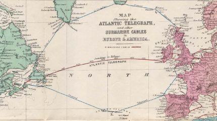
A collection of maps of undersea cables, beginning with Atlantic telegraph cable maps from 1858 and finishing with a world cable map from 1992. Most of the maps are older, though, and quite interesting. Via Things Magazine.

The Map Room is a blog about maps by Jonathan Crowe, covering everything from collecting to the latest in geospatial technology.
It returned in January 2016 after a four-year hiatus.
Comments
blog comments powered by Disqus