Australia on the Map, 1606-2006
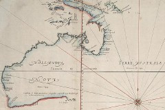 Australia on the Map, 1606-2006 is a web site that commemorates the 400th anniversary of the first charting of Australia by European explorers. For our purposes, the neatest part of the site is five scans of early maps of Australia dated 1606 to 1814. Via MapHist.

Comments
blog comments powered by Disqus