Santa Cruz’s 1550 Map of Mexico City
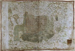 A 1550 map of Mexico City by cosmographer Alonso de Santa Cruz, currently held at the University of Uppsala in Sweden and normally not available to the public — it’s only one of two maps of 16th-century Mexico City — is now accessible online (project page). The map is zoomable but can also be annotated, and there are a few annotations on the map already. Via Cartography.

Comments
blog comments powered by Disqus