Maps of North Carolina
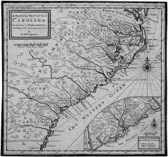 This is a nice find: a good-sized collection of maps of North Carolina, some dating as far back as the 17th century. The maps were scanned by the state archives; the ones I perused were in quite high resolution. Some of the scans are of photocopies (such as the 1730 map of the Carolinas’ coastline at right) but are nevertheless clear. Via MapHist; see also First Printing.

Comments
blog comments powered by Disqus