More Israel-Lebanon Situation Maps
Ogle Earth reports on improvements to the Google Earth layer (KMZ format; see previous entry): “It’s kept up with events on both sides of the border, and now comes with folders for individual days. There are also very recent overlays of Getty Images showing Beirut airport and Jiyeh after the air attacks.”
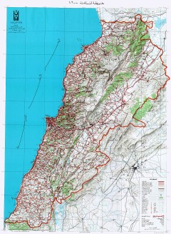 In addition to that KMZ file, Al Mashriq also hosts a number of other map resources, including scans of a 1:200,000 map of Lebanon, scans of a 1968 map of Beirut, a map showing the Israeli occupation zone as of January 1998 and a map of Israel’s air strikes from July 12 to 22 (PDF). Via Cartography.
Also via Cartography (though I wouldn’t use “delicious” to descibe them), infographics from the New York Times (JPEG) that illustrate the power dynamics of the region.
Finally, Koolyoom.com collects several Google Maps mashups related to the situation. Via Google Maps Mania.
See previous entries: Israel-Lebanon: Visualizing Scale; An Israel-Lebanon Roundup; More Israel-Lebanon Mapping; The Range of Hezbollah’s Rockets; The Israel-Lebanon Situation.

Comments
blog comments powered by Disqus