Review: Seeing Through Maps
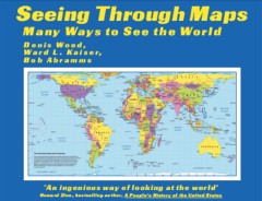
Seeing Through Maps
by Denis Wood, Ward L. Kaiser and Bob Abramms
ODT, 2006. Softcover, 160 pp. ISBN 1-931057-20-6
 It’s really not a difficult concept: there are no “right” and “wrong” cartographic projections. Each has its own advantages and disadvantages, and as such is better for some purposes and less good for others.
But considering the fuss that has been kicked up in some quarters about the “right” cartographic projection to use on maps of the world, you’d think it was otherwise. The Mercator projection has been derided as unfair — imperialist or even racist — in some quarters, because it distorts the size of the polar regions to the point where they dwarf the (much larger in real life) equatorial regions. But the widely proselytized Peters projection (see previous entry), developed by the late Arno Peters as a “fairer” projection that shows the world’s continents in their proportionate size, has come under criticism itself, as much because of Peters’s own rhetoric as the fact that, in preserving equal areas, it badly distorts continents’ shapes.
Seeing Through Maps, now in a new second edition, and its new companion DVD, Many Ways to See the World, address this question by — finally — shedding more light than heat on it. Published by ODT, the distributors of the Peters map (see previous entry), the book and DVD nevertheless take an even-handed, if not necessarily agnostic, approach to the question of which map projection is best for world maps. Each projection, the authors correctly point out, involves some tradeoffs: the Mercator sacrifices proportionality to preserve compass angles; the Peters distorts shape to preserve equal areas. That the Peters is preferred to the Mercator is a result of which values are deemed important to the map — values that are not inherent to the projection.
Many projections are given as examples: the Peters is, it turns out, not the only equal-area map in existence (see, for example, the Mollweide or Goode’s Homolosine); it is, however, one of the few cylindrical equal-area maps. And most world maps currently in production involve a “compromise” projection, like the Van der Grinten, Robinson or Winkel Tripel (all of which, incidentally, have been used at one point or another by the National Geographic Society): each sacrifices a little — curved graticules, distorted areas, distorted shapes, but none as much as in other projections — to achieve an overall picture that “looks right.” Which is about as valid a criterion for a world map as anything else, I think. (It’s worth mentioning that, on a visit to the local map store last weekend, I noticed that most of the wall-sized world maps for sale were either in the Van der Grinten or Winkel Tripel projections; there was one Peters and one Mercator, plus one or two other cylindrical projections.)
The book and DVD provide an intellectual framework in which alternative map projections like the Peters and Hobo-Dyer — a newer cylindrical equal-area projection also published by ODT — can be accepted without politicizing cartography. The Peters and Hobo-Dyer maps work well when the emphasis is on equatorial areas, less so when dealing with polar regions. As a Canadian, for example, I feel that the Peters and Hobo-Dyer maps distort my country too much for them to be of much appeal to me. But that’s all right, because other projections will suffice; there’s a reason why maps of Canada are almost always on a conical projection.
Seeing Through Maps is an excellent introduction to the challenges faced — and the choices made — in making map projections. And maps generally: it also touches on cartograms, the tube map, and other creative ways of presenting geographic information. As a high school-level resource it would be ideal.
As for Many Ways to See the World, its heart is a thirty-minute talk by Bob Abramms that outlines the same points as the book, but also discusses some of the personalities behind the projections and other unique maps. It’s an effective presentation, and I enjoyed it. The DVD, which also has short videos about the book, ODT and Arno Peters, and the slides from Abramms’s talk, could be a bit more polished, though.
Both the book and DVD were a little weak in terms of illustrations: the line art for projections got a bit repetitive, with some maps being shown several times; while other projections that I’d like to have seen — for example, an Africa-centred Winkel Tripel or a gnomonic projection — weren’t there.
ODT has loftier goals than making a basic point about cartography. Originally a management consulting company, they use maps as a teaching tool to encourage people to approach their subject matter from a different viewpoint. The thought is that showing someone a Peters map or an upside-down map forces them to look at the world differently. We know that maps are normative, not just descriptive; teaching people that maps are about presentation and choices rather than a neutral reflection of reality — as Wood does with John Krygier in Making Maps (see review) and Mark Monmonier does in How to Lie with Maps (see review) — is important stuff.
I received review copies of this book and DVD. More on my book review policy.
See previous entry: New Edition of Seeing Through Maps.
- Buy Seeing Through Maps at Amazon.com

Comments
blog comments powered by Disqus