Choropleth Map of Flickr Photos
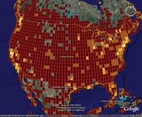 A choropleth map of Flickr photos as a KMZ file for Google Earth; it shows how many photos from each lat/long grid have been uploaded to Flickr. I was intrigued to see that unexpected places like St. Helena and Greenland have had photos uploaded. (What, no photos from Tristan da Cunha?) Via FlickrBlog.

Comments
blog comments powered by Disqus