Mapping Medieval Towns
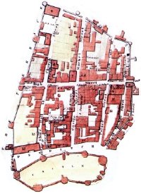 Mapping the Medieval Urban Landscape was a two-year project to study the design and planning of towns in the Middle Ages for which historical records no longer exist. The project, which focused on a dozen of Edward I’s “new towns” (built in England and Wales between 1277 and 1303), sought to reconstruct the towns’ plans based on what’s left today. The results can be examined in a new online atlas: maps of the towns can be accessed through a GIS interface or downloaded as static files. Via Urban Cartography; see also Cartography.

Comments
blog comments powered by Disqus