Atlas de Trudaine
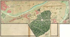 BibliOdyssey introduces us to an online collection by France’s national archives of the Atlas de Trudaine, a series of more than 3,000 maps made by Charles-Daniel Trudaine between 1745 and 1780. “The maps themselves are highly detailed and were originally commissioned to plot the royal roads. But they constitute a significant and broad 18th century historical corpus, documenting parks, churches, convents, cemeteries, ruins, castles, waterways and essential geophysical features in the landscape.”

Comments
blog comments powered by Disqus