New, Free Physical Map of the United States
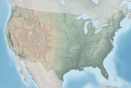 Tom Patterson — whom we know from his Shaded Relief site — wrote to announce an excellent relief map of the United States that he made from SRTM and other data and released to the public domain. (Methodology here.) It’s available in several sizes and variants and has a gallery of enlargements and a Zoomify version available online.
See previous entry: Shaded Relief.

Comments
blog comments powered by Disqus