The Atlantic Neptune
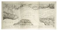 The Atlantic Neptune, “a magnificent four-volume atlas of sea charts and views of the east coast of North America, published during the American Revolutionary War by Joseph Frederick Wallet Des Barres (1722-1824),” has been scanned and put online by the National Maritime Museum. Via MapHist.

Comments
blog comments powered by Disqus