Visualizing U.S. and German Postal Codes
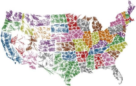
The U.S. ZIPScribble Map by Robert Kosara plots U.S. ZIP codes in ascending order, one connected to the next. Pretty! A similar map applies the same method to the travelling salesman problem: it maps the shortest distance between ZIP codes.
Inspired by Kosara’s maps, Stefan Zeiger does the same things for Germany.

Comments
blog comments powered by Disqus