Interstate Highway Diagram
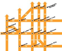 Chris Yates has created a Beck-style diagram of the Interstate highway network — simplified, of course, so not every highway is listed. Interesting to see how the grid works: this is something my younger self, armed with an out-of-date Rand McNally road atlas, would have spent a lot of time playing with. Prints are available. Via Boing Boing.

Comments
blog comments powered by Disqus