Rediscovered Maps at Brown University
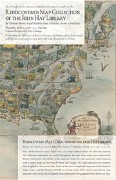 An exhibit at Brown University’s John Hay Library opens on Monday and runs until April 25: it features some of more than one thousand maps “rediscovered” in that library.
The collection represents the world throughout the time these maps were collected by Brown University. Two-thirds of the maps are from the 1800s and early 1900s, with a major focus on the United States and Europe. The local collection for southern New England is also noteworthy. Some of the more exceptional maps are a Nazi tourism map, a map cited by Herman Melville in writing Moby Dick, and an anti-slavery map donated to the Library by the family of an abolitionist who graduated from Brown in 1831.
A talk will be given on April 5. I’d love to know how these maps came to be “rediscovered,” and to what extent they were simply “uncatalogued.” The Providence Journal had a story about this collection in February that would presumably answer my question, but it’s behind a fairly strong subscriber wall and I haven’t seen it. The Associated Press had a story last November about Brown’s cataloguing efforts, but did not make as much hay about the “rediscovery” aspect of this story.
Via Map the Universe, Map History/History of Cartography and Maps-L.

Comments
blog comments powered by Disqus