San Francisco Fire Insurance Maps
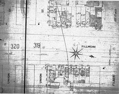 Alberto has uploaded a collection of microfilm copies of San Francisco fire insurance maps dating from around 1905 — which wuld have been just before things got very interesting indeed from a fire perspective. The trouble with microform copies of fire insurance maps (apart from the inherently low quality of such copies) is that fire insurance maps are in colour — in the maps I’ve seen, the colour shows what a building is built of. So there’s something lost in monochrome microform reproduction. Via Things Magazine.
Previously: New York Fire Insurance Maps.

Comments
blog comments powered by Disqus