Historical Atlas of Canada
 The huge Historical Atlas of Canada was published in three volumes between 1987 and 1993. An online version, the Historical Atlas of Canada Online Learning Project, is now being developed by the University of Toronto’s geography department. It would have been impressive enough as scans of the original atlas, but the online atlas is a mixture of static maps (presented in popup windows) and interactive maps powered by ArcIMS. I’m not overly fond of the ArcIMS interface, which in my opinion strains the definition of “user-friendly” and in this particular case is very slow, but this method is still the right way to express changes over time of things like boundaries, which is the whole point of an historical atlas.
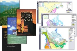
- Buy Historical Atlas of Canada I: From the Beginning to 1800 at Amazon.com (Amazon.ca)
- Buy Historical Atlas of Canada II: The Land Transformed, 1800-1891 at Amazon.com (Amazon.ca)
- Buy Historical Atlas of Canada III: Addressing the Twentieth Century at Amazon.com (Amazon.ca)
- Buy Concise Historical Atlas of Canada at Amazon.com (Amazon.ca)

Comments
blog comments powered by Disqus