Mapping Snow Cover
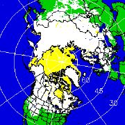 On a day like today, with a whole pile of snow waiting outside for me to shovel, Leszek’s link to the National Operational Hydrologic Remote Sensing Center, which at this time of year provides all kinds of snow-related information, seems timely. The NOHRSC site includes interactive snow information maps and national snow analyses (plus Google Earth versions), which aren’t much help to me in Canada, but the maps showing northern hemisphere snow cover certainly apply.

Comments
blog comments powered by Disqus