Obama’s Inauguration from Orbit
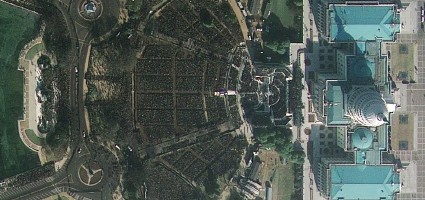
As usual, I’m just about the last person to mention GeoEye’s high-resolution satellite image of the crowds attending President Obama’s inauguration, less than an hour before he was sworn in. It’s available as a KML layer for Google Earth; Stefan has some notes on the resolution of various available versions, from GeoEye’s downloadable version and the KML file to CNN’s click-and-drag version. Via too many sources to mention. (Satellite image courtesy of Geoeye.)

Comments
blog comments powered by Disqus