ESA Maps European Shipping Routes
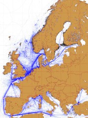 The European Space Agency has released maps showing European shipping routes, based on seven years’ worth of radar tracking. The ESA also correlates these routes with NO2 emissions; marine engines apparently burn rather dirty fuel. Via La Cartoteca.

Comments
blog comments powered by Disqus