National Geographic Award in Mapping
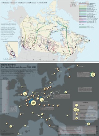 Both the first- and second-prize winners of this year’s National Geographic Award in Mapping are graduate students from the University of Wisconsin, Madison — a fact that the university’s geography department trumpets. Rising Skyline: The Tallest Buildings in Europe, 1875-2007 (680 KB PNG) by Daniel Huffman, which maps “the location of each of the 118 buildings ranked among the thirty tallest buildings in Europe at some point between 1875 and 2007,” came first; Ben Coakley’s map, Scheduled Service on Small Airlines in Canada, Summer 2008 (2.2 MB PDF), came second. Third prize went to Gregg Verutes of San Diego State University for his interactive map of Accra, Ghana (10 MB flash). Via AnyGeo.
Previously: National Geographic Cartography Award Winner.

Comments
blog comments powered by Disqus