Atlas of Historic New Mexico Maps
Ellen writes to tell us about the Atlas of Historic New Mexico Maps:
More than just another collection of historic maps! The Centennial Atlas offers 20 historic maps created over four centuries years of New Mexico’s history, annotated with the stories of the people who were there at the time the map was made, illustrations and photographs, audio, links, oral histories, and more. Lesson plans support classroom use of this resource as well as offering a place for students to add their own rich media maps of their community’s history, by uploading KML files. Created by the New Mexico Humanities Council for New Mexico’s upcoming celebration of Statehood in 2012.
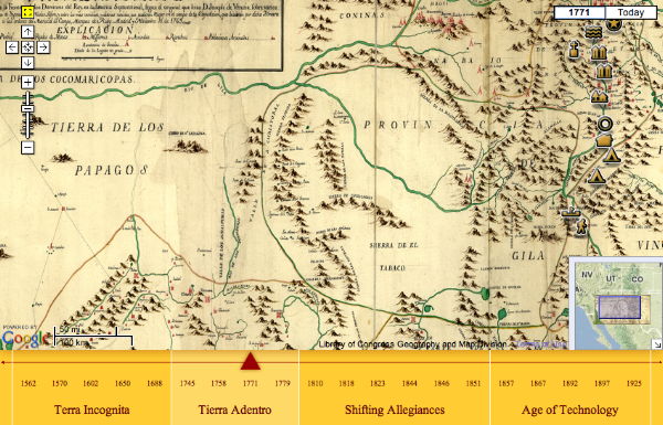
The maps are presented as an overlay in Google Maps, with pushpin annotations. Above: Joseph Ramon de Urrutia, Primera parte del Mapa, que comprende la Frontera, de los Dominios del Rey, en la America Septentrional (1771).

Comments
blog comments powered by Disqus