Mapping the Moon using Kaguya’s Laser Altimeter Data
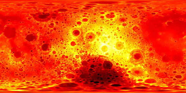
Here’s a map of the Moon generated by laser altimeter data from the Japanese lunar probe Kaguya, which has just been released. In this image, brighter/yellow is higher elevation, darker/red is lower elevation. This map is centred on the far side of the Moon, which obviously has some interesting stuff going on topographically. (Image credit: JAXA/SELENE.) On the Planetary Society’s blog, Emily Lakdawalla shows a bunch more of these maps, plus some examples of what happens when this data is mapped to a sphere using Celestia — including this video of a rotating Moon, which was generated not from imagery but from this altimeter data:
Previously: Kaguya’s Lunar Topo Maps.

Comments
blog comments powered by Disqus