Haitian Earthquake: Links for January 16
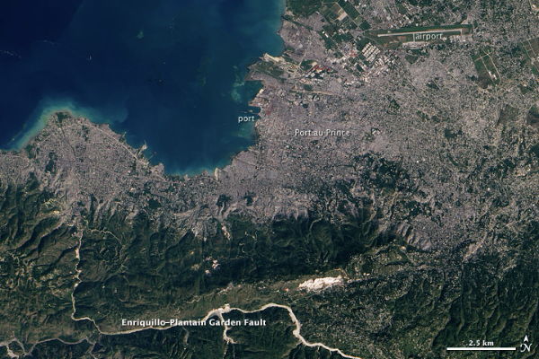
NASA’s Earth Observatory on the above image: “While not detailed enough to reveal earthquake damage to houses and buildings, this regional view of Port-Au-Prince, Haiti, on January 15, 2010, illustrates some of the physical obstacles that have complicated the job of aid workers in the aftermath of the recent earthquake along the Enriquillo-Plaintain Garden Fault south of the city.”
Slashgeo, news that an unmanned drone from the U.S. Air Force has been diverted to Haiti to take aerial photos of the damage.
Space.com has a story about efforts by several agencies to provide satellite imagery of the disaster.
Google notes that Map Maker data for Haiti is available for download.
Open data can also be viewed in ESRI’s GEO Viewer; via AnyGeo.
More pages of mapping and geospatial resources: All Points Blog, ESRI.
Multiple CrisisCamp events are taking place today “to bring together volunteers to collaborate on technology projects which aim to assist in Haiti’s relief efforts by providing data, information, maps and technical assistance to NGOs, relief agencies and the public.”
Previously: Haitian Earthquake: Links for January 15; ESA Satellite Imagery of Port-au-Prince; Mapping the Destruction in Port-au-Prince; Mapping the Haitian Earthquake.

Comments
blog comments powered by Disqus