Mapping the Chilean Earthquake’s Tsunami
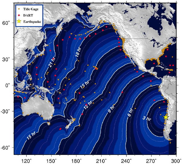
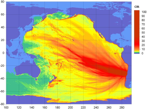
I’ve found two NOAA maps showing the progress and impact of the tsunami generated by this morning’s 8.8-magnitude earthquake in Chile. Note that the wave is happening as I write this and that by the time you read this post these maps may well be out of date.
This map shows the estimated travel times for the tsunami wave:
Via Phil Plait, this map projects the spread of the quake’s energy across the Pacific Ocean:
Phil says: “It’s unclear to me just how big a wave this means in terms of real height (it’s a model, not an actual measurement), but it should bring home that you should take this seriously.”
The Pacific Tsunami Warning Center has no equivalent maps, but does have plenty of data.


Comments
blog comments powered by Disqus