Eyjafjallajökull
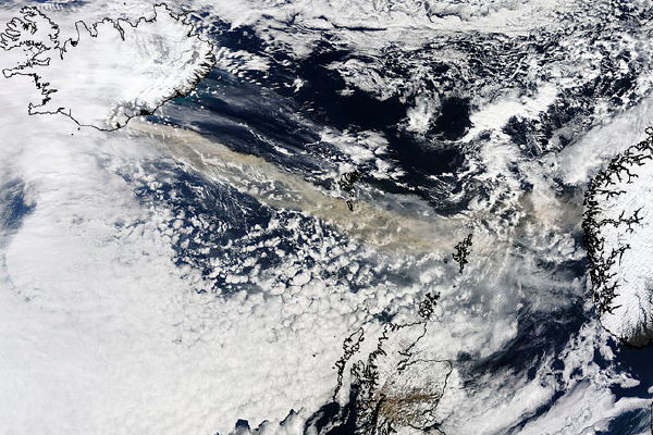
There are satellite images of the ash clouds thrown up by the eruption of the volcano under Iceland’s Eyjafjallajökull glacier; the one above, captured by NASA’s Terra satellite on Wednesday, shows the ash plume following a straight line from the glacier to the Faroe and Shetland Islands. Here’s an alternate link; these images show a closer view of Eyjafjallajökull. More about this at Universe Today and Bad Astronomy. See Google LatLong and Google Earth Blog on viewing the imagery in Google Earth. See Google Maps Mania on maps showing the impact of the ash plume on air traffic in northwestern Europe.
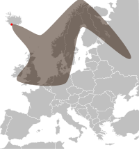 Update: The Met Office has maps forecasting the ash cloud’s spread; this map on Wikimedia Commons is derived from that data.
Update, 6:43 PM EDT: NASA’s Earth Observatory has a map of “aerosol optical thickness,” on the basis that satellite imagery is insufficient at showing the problem.
Update, April 16 at 6:20 PM EDT: NASA continues to add satellite imagery, including some telling infrared imagery, to this page.

Comments
blog comments powered by Disqus