Mapping the Muni
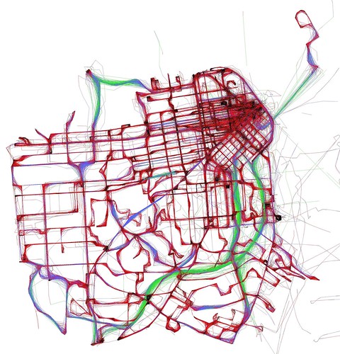
Eric Fischer took publicly available data from the Muni — the San Francisco Municipal Transportation Agency — showing the geographic coordinates of their vehicles to create this map showing average transit speeds over a 24-hour period. “Black is less than 7 mph. Red is less than 19 mph. Blue is less than 43 mph. Green is above that.” Via (and with thanks to) Burrito Justice.

Comments
blog comments powered by Disqus