Review: National Geographic World Atlas
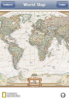
![]() National Geographic World Atlas is a $1.99 application for the iPhone and iPod touch (iTunes link) that provides high-resolution scans of National Geographic’s wall maps. Included are standard, executive and satellite versions of National Geographic’s world map in the Winkel Tripel projection. This makes for a rather large download (49.7 MB) for an iPhone app. Zooming in changes the view to the appropriate continental map. Map tiles for the continental maps are downloaded over the network, but the entire maps can be downloaded for offline use.
National Geographic World Atlas is a $1.99 application for the iPhone and iPod touch (iTunes link) that provides high-resolution scans of National Geographic’s wall maps. Included are standard, executive and satellite versions of National Geographic’s world map in the Winkel Tripel projection. This makes for a rather large download (49.7 MB) for an iPhone app. Zooming in changes the view to the appropriate continental map. Map tiles for the continental maps are downloaded over the network, but the entire maps can be downloaded for offline use.
 At higher zooms, the app switches over to Bing Maps, which makes this app a Bing Maps viewer as well. (See the announcement on the Big Maps Blog.) The Bing Maps feature works well, and is an interesting combination that plays to each kind of map’s strengths: online maps do not necessarily do large scales very well, and there’s only so much you can zoom in on a print map. (Of course, it requires a network connection.)
The app is also GPS-aware, but I was unable to test that on my first-generation iPod touch. Rounding out the app is a database that provides flags and other basic geographic details for every country and territory on the planet.
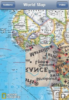 Early versions of this app were not as stable as I would have liked, and I still get a crash now and then. The initial version I downloaded in January had an interesting tile bug (right) that has not reappeared after subsequent upgrades.
Its price point is kind of awkward: an app dedicated to presenting more, or even all, of National Geographic’s maps would almost certainly cost more but would be awesome — I’m big a fan of their cartography. At $1.99, though, it has to offer more than a free app. I think the price is reasonable for what you get, but I’m not jumping-up-and-down excited — it’s fair value.
It’s also rather limiting to look at a large map on an iPhone’s rather small screen; these maps beg for a larger screen. As such, I’d have no hesitation grabbing the iPad version of this app, which also costs $1.99. If I had an iPad, that is (in Canada: have to wait).

Comments
blog comments powered by Disqus