More Deepwater Horizon Oil Spill Maps
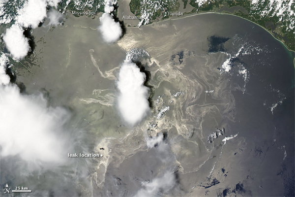
Above, a MODIS image from NASA’s Terra satellite, taken last Saturday, showing the spread of the Deepwater Horizon slick in the Gulf of Mexico.
NOAA has released an interactive map that “integrates the latest data the federal responders have about the oil spill’s trajectory with fishery area closures, wildlife data and place-based Gulf Coast resources — such as pinpointed locations of oiled shoreline and current positions of deployed research ships — into one customizable interactive map.” More information here. Via Ogle Earth.
Ted Weinstein sends along a link to this animated map showing the spread of oil rigs in the Gulf of Mexico since 1942:
The video’s author discusses the maps and data here and here.
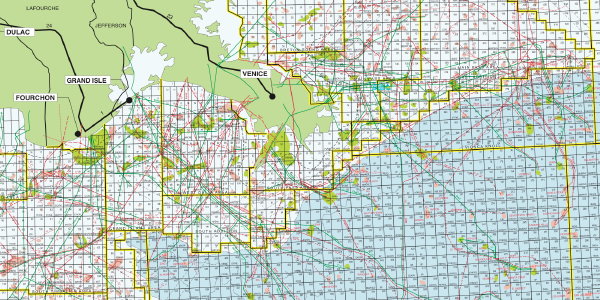
Via Boing Boing, Mother Jones looks at a poster map from Offshore magazine (16.6-MB PDF) showing the Gulf of Mexico as a network of drilling leases, pipelines, and other oil and gas infrastructure. “Where most people look at the Gulf, they see a vast marine ecosystem, wetlands, and, until recently, gorgeous beaches. What energy executives see is a massive grid, tangled with scores of oil and gas pipelines and rival fields with macho names that sound like heavy metal bands, black-diamond ski runs, and weapons systems.”
Also via Boing Boing, the American Bird Conservancy has issued a map showing the location of Globally Important Bird Areas in relation to the oil spill.
My entries on this oil spill now have their own category archive.

Comments
blog comments powered by Disqus