An Astronomy Roundup: Mars, Microsoft and More
Three related astronomy-related items:
 Microsoft’s Terapixel project reprocesses images from the Digitized Sky Survey and makes “the largest and clearest image of the night sky ever produced” available in Bing Maps and WorldWide Telescope. More at HPCWire. Via Gizmodo.
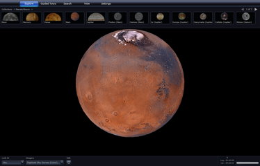
Staying with Microsoft, a high-resolution 3D map of Mars, based on imagery from the Mars Reconnaissance Orbiter’s HiRISE camera and less-high-resolution imagery and elevation data from the Mars Global Surveyor, is now available on Bing Maps and WorldWide Telescope: Bing, Microsoft, NASA. There are 13,000 images from the preposterously hi-res HiRISE camera, all geolocated, but that’s still only one percent of Mars so far. Via Gizmodo and Universe Today.
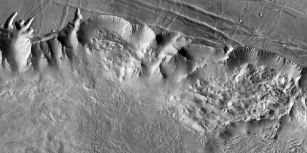
Staying on Mars, a new global map of Mars, produced from data collected from the Mars Odyssey orbiter, is now available online. “The map was constructed using nearly 21,000 images from the Thermal Emission Imaging System, or THEMIS, a multi-band infrared camera on Odyssey,” says the NASA press release. “The pictures have been smoothed, matched, blended and cartographically controlled to make a giant mosaic. Users can pan around images and zoom into them. At full zoom, the smallest surface details are 100 meters (330 feet) wide. While portions of Mars have been mapped at higher resolution, this map provides the most accurate view so far of the entire planet.” Emily Lakdawalla has more. Image credit: NASA/JPL/Arizona State University.

Comments
blog comments powered by Disqus