Darker Than You Think
Last year, Sky and Telescope’s Tony Flanders questioned the accuracy of the standard light-pollution maps, noting that in certain areas, local conditions were considerably darker than the maps indicated. Now Tony reports on some new developments:
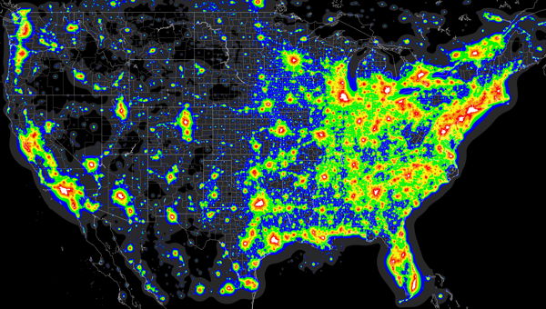
In a recent post in Cloudy Nights’ Light Pollution Forum, David Lorenz published data that very strongly suggest that the original Light Pollution Atlas was systematically biased by the fact that snow was on the ground when the underlying satellite measurements were taken. Lorenz recalculated the light pollution for the U.S. and southern Canada based on snow-free satellite observations, and the whole northern part of the area came out roughly one full zone darker. That means that the original atlas overestimate the skyglow in this area by a factor of three.
Lorenz has put together maps of the U.S. that show the corrected skyglow zones; they include my location in Canada as well, which is apparently a lot darker than I thought it was.
Previously: Light Pollution Maps; Testing Light-Pollution Maps; Testing Light-Pollution Maps Redux.

Comments
blog comments powered by Disqus