Map of Britain Based on ‘a Network of Human Interactions’
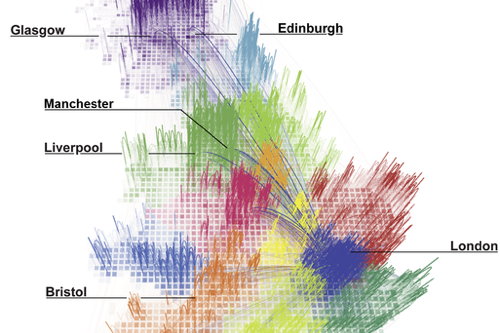
Researchers tested whether regional boundaries reflected natural human relationships by examining telephone call data in Great Britain. Based on the length and frequency of calls between locations, they were able to create regions based on those networks. From the abstract: “Our partitioning algorithm yields geographically cohesive regions that correspond remarkably well with administrative regions, while unveiling unexpected spatial structures that had previously only been hypothesized in the literature.” Read the full article here. Via io9.

Comments
blog comments powered by Disqus