Mapping American Slavery
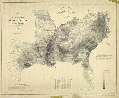
Historian Susan Schulten, writing for the New York Times’s online Opinionator feature, examines an 1861 map showing the distribution of the slave population in the southern states of the U.S., based on 1860 census data. This map, an early example, I think, of a value progression map, was, according to Schulten, extremely influential in its day. An annotated version looks at some of the map’s details; a PDF version is available for download. Via @mrgeog.

Comments
blog comments powered by Disqus