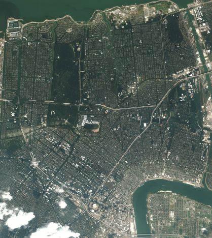
Hurricane Katrina: More Satellite Images
(Updated) More satellite imagery from the areas affected by Hurricane Katrina is being made available. Space Imaging’s Image Gallery has images of New Orleans before Katrina and Mobile, Alabama after Katrina (via Cartography). Digital Globe’s Hurricane Katrina Media Gallery has before/after images of New Orleans and post-hurricane images of Biloxi, Mississippi at the moment (via Spatially Adjusted; see also Kathryn Cramer).
More images are undoubtedly coming. Pace Sean’s concern that flashy web maps are not what’s so badly needed — and he does have a point: MSNBC’s mapping feature (via Scoble) is seriously overproduced — people are desperately trying to find out what happened, and maps and satellite images are the best way to get the “big picture” at a glance.
(As with the previous entries on Hurricane Katrina, this entry will be updated as more links are found until it is superceded. Check back.)
See previous entries: Hurricane Katrina; Hurricane Katrina: The Aftermath; Hurricane Katrina: Before and After.
Update, 12:15 PM:
The full-sized image is 3.2 MB, about which Steve Stone says, “As you scan across it, you will see that the darker areas are flooded … as you head south toward the Mississippi and the French Quarter, you can see dry land … the darker the areas, the deeper the water. It is hard to fathom how many thousands of homes are in that darkness.”
See also: Kathryn Cramer’s How to find out if your New Orleans house is underwater, involving comparing your address to current satellite images.


Comments
blog comments powered by Disqus